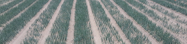
Rob and his wife, Eliza, are now the fourth generation farming Greenvale, which was traditionally, a 100% dryland, prime lamb operation. It is now a diversified farming business with an extensive cropping program and a small breeding flock of crossbred ewes which are run alongside a lamb trading operation.
The farm has a long term average rainfall of 680mm and is now 60% covered with fixed pivot irrigators, reducing the risks of dry seasons. Soil types range from very heavy black canola running up to lighter sandy loams.
Over recent years, extensive development work has been put into practice. Technology has been implemented into the farming system to gain efficiencies in production and labour, such as livestock handling equipment, variable rate irrigation, Fieldnet, RTK guidance NDVI images underground drainage and grid soil mapping.
The introduction of PA has been implemented over a decade but in recent years the adoption of VRI and NDVI has taken this to a new level. It dramatically altered the way we view our crop management and has opened up many opportunities to increase production but at the same time reduce inputs
The operation now has a well-balanced irrigation system complementing the cropping and lamb production, allowing turn off lambs all year round.
In the 2012-13 growing season the Plant and Food researchers surveyed commercial potato crops in Canterbury and confirmed grower concerns that a “yield plateau” of approximately 60 t/ha was common. At this level, potato growing is becoming uneconomic.
Plant and Food Research computer-based modelling shows that yields of 90 t/ha (paid yield) are theoretically possible in the surveyed paddocks in most years. This shows a “yield gap” of about 30 t/ha.
The most important factors found to be reducing yield were soil compaction, the soil-borne diseases Rhizoctonia stem canker and Spongospora root galls.
Tuber health, disease management, soil compaction and irrigation all have ability to reduce yields
Using CORE funding, Sarah and colleagues have been running a number of related trials, comparing field performance with modeled potential growth rates. They’ve used DNA to assess soil pathogens, applied a range of treatments and measured disease incidence and yields. They have also looked at the role of seed quality in potato emergence, variability and yield.
But it is not all about diseases. Soil compaction, structure and related issues such as aeration, drainage and water-holding show up as crop limiting factors. Also implicated are irrigation management and weeds.
Potatoes NZ reports that the use of guidance technology and variable rate application based on soil testing is being undertaken but there is limited crop based management of inputs. There may be opportunity to manipulate some inputs.
In paddock variability can be relatively easily identified using remote sensing equipment (both NDVI and Infrared) but there are three major problems with potatoes which are:
Remote sensing can identify differences in a paddock but these need to be ground truthed to determine what the reason for the difference is – e.g. canopy disease etc.
Often by the time a difference is apparent on a crop sensor map, even when it is ground truthed, growers cannot implement a management decision that will change the crop performance.
Yield maps are generally used as the baseline reference for Precision Agriculture and this is difficult and expensive to implement for potatoes.
Dr Jane Adams, OnionsNZ Research and Innovation Manager, says the project, “Enhancing the profitability and value of New Zealand onions” is designed to provide the industry with tools to monitor and manage low yields and variability in onion yield and bulb quality.
It will incorporate precision agriculture with initial work to be done at the LandWISE MicroFarm. At the MicroFarm, we have been building increasing knowledge of the site, but will ramp that up with more layers of soil and crop information as we try to unpick factors contributing to lower yields and reduced quality.
Information about the 2014-2015 MicroFarm Onion crop can be found on the MicroFarm website.
The project proper starts on 1 July, but there has a lot of preparatory activity to ensure everything kicks of smoothly.
Anyone interested in joining a regional Focus Group supporting the project should contact us>
Gert’s current work involves finding ways to build more sustainable and energy efficient homes, finding better ways for the normal household to live sustainably, and evaluating new technologies.
Gert says the most burning question in any business venture is whether your actions will cost you money, or make you money. Any decision you make in the production, marketing or operational sphere has an influence on this statement. This paradigm has been a design key since Wintec have ventured into producing cost effective sensor arrays and wireless networks.
In the modern measurement world, there are three cost drivers – quality of the sensor(s), the cost of the network carrying the data, and the cost of making sense of and using the data.
Gert and colleagues started off by looking at the network and the data carrier first, and designed a generic sensor module to host and manage almost any sensor type. They also developed a database model that would host any data from sensors, as well as the encryption and data quality protocols.
To date, their system can host the following type of sensors: GPS, Air Humidity, Air Temperature (2 sensors), Air pressure, solar irradiation, wind speed, wind direction, soil moisture (various sensors), pH, conductivity, dissolved oxygen, oxidation-reduction potential, ammonia, CO2, methane, propane, NOX and some alcohols.
A single sensor module can carry at most thirteen sensors, with a practical thirty sensor modules per network. This totals to 390 sensors per network.
This technology is being trialed at the LandWISE MicroFarm, gathering, transmitting and processing soil moisture information from an array of sensors.
Peas are one crop that has huge variation. It’s hard to know if the crop will yield four tonnes per hectare or twelve. Even within small sampling plots we measured yields less than 4 t/ha and greater than 13 t/ha. More>
Our first MicroFarm onion crop is extremely variable. We want to measure variability so we can better assess it. If we can measure objectively we can make better decisions. We are interested in spatial variability and temporal variability. More>
We have been making elevation maps of cropping paddocks. It is the first step in determining the optimum plan to manage drainage and sediment loss.
If it can, water will flow downhill. It flows faster on steeper, smoother land and faster when it is deeper. The faster it flows, the higher the risk of soil erosion and loss. If water can’t find a down-slope, it will sit until it soaks or evaporates away. If that takes too long, plants will suffer.
The rate at which water infiltrates (soaks into) the soil is largely related to soil texture and structural condition. A coarse soil generally lets water in faster than a “tight” clay soil. If the natural porosity has been damaged by over-cultivation, water movement is reduced. Other factors such as hydrophobic organic matter (think oilskin raincoats) also stop or reduce infiltration.
Step two is using a computer to analyse our detailed elevation maps and determine where water will pond and how deep it will be. Knowing how much land is affected lets us gauge the cost of ponding. We can “apply” a rain event and see where the water runs, how deep and how fast. This lets us identify, and make plans to manage, erosion risk areas.
The third step is creating plans to remove water in a controlled way; not too fast and not too slow. For many years this has been done by laser-grading. This creates a flat plane with a set slope so water can drain at a set rate across the land. Unfortunately it often requires a huge amount of soil movement.
High accuracy GPS and smart software has enormous benefits. Our detailed elevation maps are analysed to create optimised cut-and-fill plans that move only enough soil to enable surface drainage. We don’t mind that the surface is not a flat plane, so long as the water can move. We can set the maximum slope (to avoid erosion) and the minimum slope (to avoid ponding) and the direction we want water to flow.
OptiSurface software calculates where to cut high points and fill low points, balancing the soil so one just fits the other. Rather than a flat plane, we get a varied terrain with lower points connected to ensure drainage. While much is automated, there is still a need for farmer and designer input. The theoretical design must be practical.
Once completed, design files are loaded back into the tractor which controls the height of a levelling blade to get the exact cuts and fills we have determined. Advice is to use the same type of GPS for both surveying and levelling. Subtle differences between brands and even models of GPS system can create problems. It is also important to have a base station within 2 km so the vertical error is minimised. Having 40 or 50mm of GPS error when the soil cut is 20mm just doesn’t work.
The series of maps cover a case study 40ha cropping property. We mapped it using the farmer’s Trimble FmX and analysed the data in OptiSurface.
Map 1 shows the existing topography on the farm, each colour change being a 1m change in elevation.
Map 2 shows where water will pond, and how deep it will get.
Next we looked at some solutions.
Map 3 shows the possible topography if part was levelled to a single plane (purple through green strips) and part was OptiSurfaced (green through red strips).
Map 4 shows the cut and fill required to achieve each solution. The amount of movement for a single plane is huge – over 700m3/ha for single plane and under 20m3/ha for OptiSurfaced areas.
Map 5 shows the cut and fill required if the whole area is optimally resurfaced.
A new initiative in Horowhenua will reduce sediment and nutrient input into the Arawhata Stream and Lake Horowhenua. And it will increase farm productivity by managing drainage and reducing crop losses.
LandWISE is working with local farmers, the Tararua Vegetable Growers’ Association and Horizons Regional Council in this Ministry for the Environment supported project.
The team will create integrated drainage and sediment control plans for up to 500ha of cropping farms. The plans will identify ways to manage risks using mix of land shaping and storm water management, supported as necessary by erosion control and sediment capture techniques. Where appropriate, cut and fill plans for reshaping will be prepared, enabling farmers to have automatic control of earthmoving equipment.
The current drainage system, actually the legacy of an historic stock drinking water race scheme, cannot contain run-off from severe storm events. Inadequate drains spill flood waters on to cropping land, creating strong rivers that erode cultivated soil and wash it, along with crops, into the Arawhata and into Lake Horowhenua. Nobody wins.
When drains fail, flood-generated erosion destroys valuable crops and discharges sediments to the stream and lake (John Clarke photo)
Local grower, John Clarke, believes additional drainage he has installed has addressed a large part of the problem. Interceptor drains and increased capacity capture and contain water from higher up the catchment, and guide it safely to the outlets.
More is needed. The whole system must work together from top to bottom. A problem on one farm inevitable flows on to the next.
Horizons staff have completed a survey of the existing drainage system, measuring channel dimensions and culvert sizes. They met with local growers to hear first-hand of the issues the growers understand only too well. They are now designing a new system that will be the core of enhanced drainage in the catchment.
Stock water system culverts do not provide necessary drainage capacity. A redesign is needed
On-farm, precision surveying with GPS tractors has begun. Using their Trimble technology, the growers can map their properties in 3D, with an error of millimetres.
High precision survey creates very accurate maps and allows drainage analysis and planning
The data collected will be processed using OptiSurface software that determines ponding areas, flow paths and depths. It can create optimized cut and fill plans requiring the minimum amount of soil movement that allows effective drainage. Those plans are fed back into the tractor guidance system and control the blade depth on ground shaping equipment.
Expectations are that ponding areas will be identified and removed through strategic levelling. This removes two problems: the bathtubs of ponded, stagnant water that can collect and row ends and destroy crops, and the risk of blow-outs that cause erosion and sediment being lost to the lake.
The third level of sediment management is retaining even small amounts of sediment through use of sediment control structures and filter plantings along farm drains. Small but continuous losses add up over time and can constitute a significant loss of nutrients from the farm, as well as more sediment load into the lake.
The project will see individual farm plans for each property that can be integrated in New Zealand GAP and used to demonstrate good practice to stakeholders.
The project is one of eight that together form the Fresh Start for Fresh Water Lake Horowhenua Freshwater Clean-up Fund programme. Horizons’ Fresh Water and Science Manager, Jon Roygard notes efforts to restore the lake have been ongoing for several decades, including in 1987 stopping the discharge of raw sewage into the lake. Recently, and almost complete, a full native planting buffer strip has been established around the lake.
Other efforts include harvesting lake-weed to remove nutrients, a sediment trap where the Arawhata enters the lake, storm water treatment upgrades, a boat wash facility, a fish pass, some further riparian fencing and planting of the tributaries and work with Dairy farmers to complete farm plans.
I visited a farm in Queensland’s Fassifern Valley, Queensland. There, Michael has been using AGPSInc’s Dirt Pro for a levelling programme on his cropping farm.
AGPSInc unit installed in tractor surveys topography and guides equipment for land levelling, ditch digging and pipe laying
AGPS-Dirt Pro is GPS based software option that assists land forming. It is comparable with Trimble’s Land Level II and TerraCutta (Precision Cropping Technologies/John Deere) and effectively replaces laser technology. Dirt Pro is one element of a suite of farm drainage tools from AGPSInc, along with Ditch Pro and Pipe Pro and others.
A few aspects set it apart. For a start, it is a complete package – coming with a Windows(R) based tablet type computer that fits cleanly into any mainstream tractor and connects to a wide range of RTK-GPS units. So anyone without high end GPS could look at this as an option.
Secondly, it is a cost effective option, the full package being about the cost of another brand’s unlock code. So it could be an option if the farm does have high end GPS.
Thirdly it has an in-built version of OptiSurface so can do some optimisation to minimise soil movement. For complex analysis the full OptiSurface product is required, but this integrates easily.
So, we haven’t used it, but Michael has and says it is easy to use and effective.
But regardless, the software/hardware package is only part of the solution. There needs to be an overall farm plan, an understanding of why drain, how to drain and what is needed to achieve farm goals.
Wide swale drains have high capacity yet can be driven through and be used as turning headlands
The broad, shallow, grassed drains at the ends of Michael’s paddocks are his headlands. This approach has application in New Zealand and is another thing to follow up.
Why do we have impassable deep, narrow sprayed out ditches that erode and require headlands on either side, when a grassed swale can be driven over, used as a combined headland, and generate less sediment and maintenance?
Awapuni Function Centre, Palmerston North. 21-22 May 2014
Just two days to go to LandWISE 2014! The final programme and some tasters of individual presentations are on the website.
In a change to previous years, our “outdoor session” on Day 2 includes a bus tour of a small catchment with intensive land use – vegetable cropping and dairy farming – and a regionally significant lake. This will be in the middle of the day, with buses returning to the conference venue for the final afternoon presentations and panel discussion.
We have a focus on farm plans to avoid or minimise off-farm impacts, especially from sediments and nutrients. This is a critical issue now, and farmers need to understand how new expectations may affect their day to day activities.
Many thanks to our Conference Sponsors and the many speakers and others who bring you this opportunity. We especially thank our Platinum Sponsors, BASF Crop Protection, AGMARDT and John Deere.
Please pass this message on to your friends and colleagues you believe would gain benefit from attending.
Around 300 people attended the Silver Fern Farms Hawke’s Bay Farmer of the Year Field Day on 8 May. Hugh and Sharon Ritchie won the award and opened Horonui, Drumpeel and Wainui farms to public gaze.
A good selection of images from the day can be found on Kate Taylor’s website, rivettingkatetaylor.com. A sample image of folk at Drumpeel is below (thanks Kate)
Kate Taylor’s photo of people visiting Drumpeel during the Farmer of the Year Field Day
The weather put on a good show as 120+ utes travelled across the three farms.
Horonui has most of the rolling hill country and is the largest part of the the animal enterprise. Check Kate’s photos to see more. The flats are used for cropping with a 50ha area block irrigated by a towable pivot fitting with variable rate technology.
Drumpeel has been the cropping base since Hugh’s parents David and Sally took over the farm and began developing it. Now fully irrigated it has been the site of many trials and field days over the years by FAR and companies testing seed and plant protection options. Hugh himself is constantly testing new ideas!
Hugh has hosted many LandWISE events and supported LandWISE Smart Farming investigations including pH mapping, EM soil scanning, minimum tillage, strip-tillage. Generally he’s been ahead of us.
The Drumpeel linear move irrigator was a test-bed for LandWISE nozzle option research into improving application uniformity. This has been a passion of Hugh’s since his Nuffield Scholarship when he visited Charles Burt at the Irrigation Training and Research Center in California.
Wainui is a new aquisition that adjoins Drumpeel. The Ritchies have just completed their first summer of cropping. A large centre pivot on Wainui has variable rate irrigation which should give increased flexibility and use a set amount of water most efficiently. A programme of GPS surveying and levelling to enhance drainage at Wainui has begun. This will be discussed at the upcoming LandWISE Conference in Palmerston North on 21-22 May.
Once again, congratulations Hugh and Sharon and their family and staff.

 Rob Tole, Farmer
 LandWISE 2016