Category Archives: Irrigation

Onion Crop Development

The crop at the MicroFarm is showing increasing variability.  The cause of some is understood, essentially excessive water pre-germination.  But in some poor performing areas the causes have yet to be determined.

The effect of our artificially applied rain event pre-emergence is clearly evident in late November.

The lasting effect of a heavy (artificial) rain event pre-emergence (right panel) shows low population and poor growth compared to areas without heavy rain (left panel)

However, we also see other areas that have poor crop development that are outside the area irrigated to create the artificial rain event.

Wide variation within the area new to onions does not follow artificial rain or topographic drainage patterns.

Sharp differences in crop growth are evident in the new onion ground. Some parts that were heavily irrigated to simulate heavy rain show reasonable development. Areas that were not irrigated also show good development, but in some patches total crop loss.

Investigations of soil physical properties in these different areas are underway.

Onion Crop Research Plan

After identifying areas within paddocks that had yields limited by different probably causes, we conceived the idea of Management Action Zones (MAZs).

Yield assessments show considerable variation, limits imposed by population, growth of individual plants, or both

Some areas showed that yield was limited by plant number: establishment was poor. Others had the expected population, but low biomass: the plants were small due to some other limiting factor.

If we can identify zones easily, and determine the causes, we should be able to target a management response accordingly. So for this season, we set out a revised research aim.

What we want to know:

  • Can we successfully determine a management action zone in a field?

Why do we need to know this?

  • Develop a tool to increase uniformity and yield outcomes
  • Develop a tool to evaluate management practices and crop productivity

If we want to successfully determine a management action zone in a field then there are two main steps to achieve in this year’s work:

  • Confirm the relationship between digital data and crop model parameters
    • Does the relationship stay constant over time and sites?
    • How early in growth can a difference be detected?
    • Can the relationship be used to show a growth map across a field?
  • Develop an approach to gather information and ways to input and display results, initially using a website approach.
    • Can we integrate a plant count and yield information to start developing a management action zone?
    • How should this be put together in a way growers can start to use to gather information about their crops?

At the MicroFarm, we established six research zones based on paddock history and excessive wetness at establishment.

We have three paddock histories: two years of onion production with autumn cover crops of Caliente mustard, two years of onion production with autumn cover crops of oats, and no previous onion crops planted after previous summer sweetcorn and autumn sown rye grass. In each of these areas, we deliberately created sub-zones  by applying about 45mm of spray irrigation as a “large rain event”.

Artificial heavy rain event applied after planting and before emergence

The impact of the artificial rainstorm is evident on images taken at the end of November.

The lasting effect of a heavy (artificial) rain event pre-emergence (right panel) shows low population and poor growth compared to areas without heavy rain (left panel)

Technology to Reduce N Leaching

N-Leach_WorkshopThe Precision Agriculture Association NZ is presenting workshops focused on technologies available to help reduce nitrogen leaching. There are two North Island workshops being offered at:

Massey University on Thursday 1st September 2016 [PDF here]

and

Ellwood Centre, Hastings on Friday 2nd September 2016 [PDF here]

Programme

The ‘Technology to Reduce N Leaching’ workshops are similar to the well received program conducted in Ashburton in March 2016 and will address where we are and what we can do about nitrate leaching limits in a North Island context utilising a range of technologies and farm systems options.

The particular areas for focus for the program are:

  • Variable rate technologies and systems
  • Precision irrigation
  • Precision spreading systems and services
  • Soil mapping
  • Soil moisture monitoring, sensors, metering
  • Nutrient budgeting and environmental monitoring

A Q & A time slot is devoted in the afternoon session for attendees to interact with members and presenters on the day to share learnings and understandings about the issues. This will also be possible over the lunch break on both days with one and half hours devoted for this.

PAANZ2

Offer to PAANZ Members

As part of the Hastings program only on 2nd September, PAANZ members are offered the opportunity to participate as trade/sector participants for technologies and products as may be appropriate to support the program.

PAANZ is not able to offer trade/sector stand space at the Palmerston North venue due to space restrictions unfortunately so only the Hastings venue will be able to accommodate this option for members.

If you would like to participate please advise Jim Grennell, E-mail: jim@paanz.co.nz

Mobile: 021 330 626, places are limited to ten organisations for the Hastings workshop to be involved as a trade/sector participant so it will be on a first come basis.

The cost of participation will be $100.00 plus GST per stand with attendance fee of $100.00 per person additional.

As these are indoors Workshops, with a technology focus and space at the Hastings venue is limited no large equipment or hardware can be accommodated.

Confirmation of members wishing to take up this opportunity is required by Monday 22nd August 2016 after which time the opportunity to participate will be made available to non-members.

Rootzone reality – measuring nutrient losses

Drainage fluxmeters in commercial fields across the regions

P Johnstone, M Norris, S Green, G Clemens, C van den Dijssel, P Wright, G Clark & S Thomas
Plant & Food Research

Minimising nutrient losses from cropping systems makes good financial sense. It also minimises any adverse impacts on our waterways, which is increasingly important in many regions as new national water policy requirements are implemented.

A common theme in many regions is the requirement that growers should, as a minimum, be managing nutrients according to agreed good management practices. However, there is relatively little long-term measurement of how good management practices throughout New Zealand impact losses of nitrogen (N) and phosphorus (P) from cropping paddocks.

To help fill this gap a network of permanent drainage fluxmeters has been established in commercial fields in the Canterbury, Manawatu, Hawke’s Bay, Waikato and Auckland regions over the last 18 months. There are a total of 12 sites in the network, covering a broad range of cropping systems, soil types, climatic conditions and management practices.

At each site fluxmeters have been installed at a depth of 1 m.  Any water from rainfall or irrigation events that drains to 1 m is captured by the fluxmeters. It is then pumped to the surface and analysed for nutrient concentrations. Net losses can be estimated by combining these measured concentrations and measured drainage volumes.

Preliminary results from the network have highlighted a wide range in N and P losses in drainage water. Many of the losses have been comparatively low to date, evidence that economic and environmental risks can be successfully balanced through the integration of good management practices.

Where high losses have been observed this has resulted from large drainage losses and high nutrient concentrations in the drainage water.

Importantly, this is a long-term initiative and the value of the information from the network will increase over time as growers and regional authorities consider long-term trends.

Farmers getting value from soil EM maps

Chris SmithChris Smith
AgriOptics NZ Ltd

An electromagnetic (EM) soil conductivity Survey maps the variability in soils characteristics; these values are strongly influenced by many factors but mainly soil texture, soil moisture at the time of the survey as well as bulk density and salinity.

Combining this data with topography data collected at the time of the survey gives the farmer a powerful management tool for creating management zones for various aspects of his business, including amongst other things; managing water, zonal soil sampling, improving yield and pasture performance where soil characteristics are the limiting factors, managing inputs to targeted placement, highlighting and reducing the environmental impacts or risks.

AgriOptics has been conducting EM surveys since 2011, with various clients and in many differing scenarios and enterprises, covering over 20,000ha in that time.

This presentation explained what an EM survey is and what information the farmer receives from the service and how the different layers of data from that survey are being utilised by farmers in the South Island with both its direct and indirect uses, and how that translates into a dollar value to those clients.  Examples of both dairy and arable farmers each with not only common goals but their own specific issues and requirements were given.

Precision Agriculture in Tasmania

Where are we getting value?

RobbieToleRob Tole, Farmer
Greenvale Pastoral, Tasmania

Rob and his wife, Eliza, are now the fourth generation farming Greenvale, which was traditionally, a 100% dryland, prime lamb operation. It is now a diversified farming business with an extensive cropping program and a small breeding flock of crossbred ewes which are run alongside a lamb trading operation.

The farm has a long term average rainfall of 680mm and is now 60% covered with fixed pivot irrigators, reducing the risks of dry seasons. Soil types range from very heavy black canola running up to lighter sandy loams.

Over recent years, extensive development work has been put into practice.  Technology has been implemented into the farming system to gain efficiencies in production and labour, such as livestock handling equipment, variable rate irrigation, Fieldnet, RTK guidance NDVI images underground drainage and grid soil mapping.

The introduction of PA has been implemented over a decade but in recent years the adoption of VRI and NDVI has taken this to a new level. It dramatically altered the way we view our crop management and has opened up many opportunities to increase production but at the same time reduce inputs

The operation now has a well-balanced irrigation system complementing the cropping and lamb production, allowing turn off lambs all year round.

Investigating variability in potato crops

Sarah SintonLandWISE 2016 Conference presenter Sarah Sinton is a well experienced member of a Plant and Food Research group studying potatoes.

In the 2012-13 growing season the Plant and Food researchers surveyed commercial potato crops in Canterbury and confirmed grower concerns that a “yield plateau” of approximately 60 t/ha was common.  At this level, potato growing is becoming uneconomic.

Plant and Food Research computer-based modelling shows that yields of 90 t/ha (paid yield) are theoretically possible in the surveyed paddocks in most years. This shows a “yield gap” of about 30 t/ha.

The most important factors found to be reducing yield were soil compaction, the soil-borne diseases Rhizoctonia stem canker and Spongospora root galls.

DSC_4288sm
Tuber health, disease management, soil compaction and irrigation all have ability to reduce yields

Using CORE funding, Sarah and colleagues have been running a number of related trials, comparing field performance with modeled potential growth rates. They’ve used DNA to assess soil pathogens, applied a range of treatments and measured disease incidence and yields. They have also looked at the role of seed quality in potato emergence, variability and yield.

But it is not all about diseases. Soil compaction, structure and related issues such as aeration, drainage and water-holding show up as crop limiting factors.  Also implicated are irrigation management and weeds.

Potatoes NZ reports that the use of guidance technology and variable rate application based on soil testing is being undertaken but there is limited crop based management of inputs.  There may be opportunity to manipulate some inputs.

In paddock variability can be relatively easily identified using remote sensing equipment (both NDVI and Infrared) but there are three major problems with potatoes which are:

  • Remote sensing can identify differences in a paddock but these need to be ground truthed to determine what the reason for the difference is – e.g. canopy disease etc.
  • Often by the time a difference is apparent on a crop sensor map, even when it is ground truthed, growers cannot implement a management decision that will change the crop performance.
  • Yield maps are generally used as the baseline reference for Precision Agriculture and this is difficult and expensive to implement for potatoes.

Sarah is presenting some of her group’s work at LandWISE 2016. Look for “Investigating variability in potatoes”.

Process Pea Yields

We earlier posted an article on flowering patterns in our process pea crop. (See http://www.landwise.org.nz/projects/flowering-patterns-in-process-pea-paddocks/).

The crop included three lines of Ashton peas, and an area where irrigation was withheld to stop flowering. It also had plots where crop covers were placed at planting to minimise effects of pigeons on plant population or shoot removal.

The crop was harvested in December and yield observations made. We didn’t see significant differences either in hand harvested plots or in viner yield estimates between the seed lines or the cover options. Unfortunately we failed in our tracking of the planter position and delayed emergence strips.


Onions Research – three year project

LandWISE has partnered with Onions New Zealand and Plant & Food Research in a three year project focused on understanding variability in onion crops. The project is funding by Onions NZ and the MPI Sustainable Farming Fund.

Dr Jane Adams, OnionsNZ Research and Innovation Manager, says the project, “Enhancing the profitability and value of New Zealand onions” is designed to provide the industry with tools to monitor and manage low yields and variability in onion yield and bulb quality.

It will incorporate precision agriculture with initial work to be done at the LandWISE MicroFarm. At the MicroFarm, we have been building increasing knowledge of the site, but will ramp that up with more layers of soil and crop information as we try to unpick factors contributing to lower yields and reduced quality.

Information about the 2014-2015 MicroFarm Onion crop can be found on the MicroFarm website.

The project proper starts on 1 July, but there has a lot of preparatory activity to ensure everything kicks of smoothly.

Anyone interested in joining a regional Focus Group supporting the project should
contact us>

OnionsNZ


More adequate or less better sensor arrays and wireless networks

LandWISE 2015 Presenter – Gert HattinghInstalling the WINTEC wireless soil moisture sensor array
Installing the WINTEC wireless soil moisture sensor array

Gert Hattingh is Industry Research Champion at the Waikato Institute of Technology in Hamilton.

Gert’s current work involves finding ways to build more sustainable and energy efficient homes, finding better ways for the normal household to live sustainably, and evaluating new technologies.

Gert says the most burning question in any business venture is whether your actions will cost you money, or make you money.  Any decision you make in the production, marketing or operational sphere has an influence on this statement.  This paradigm has been a design key since Wintec have ventured into producing cost effective sensor arrays and wireless networks.

In the modern measurement world, there are three cost drivers – quality of the sensor(s), the cost of the network carrying the data, and the cost of making sense of and using the data.

Gert and colleagues started off by looking at the network and the data carrier first, and designed a generic sensor module to host and manage almost any sensor type.  They also developed a database model that would host any data from sensors, as well as the encryption and data quality protocols.

To date, their system can host the following type of sensors:  GPS, Air Humidity, Air Temperature (2 sensors), Air pressure, solar irradiation, wind speed, wind direction, soil moisture (various sensors), pH, conductivity, dissolved oxygen, oxidation-reduction potential, ammonia, CO2, methane, propane, NOX and some alcohols.

A single sensor module can carry at most thirteen sensors, with a practical thirty sensor modules per network.  This totals to 390 sensors per network.

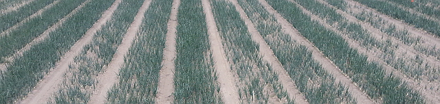
This technology is being trialed at the LandWISE MicroFarm, gathering, transmitting and processing soil moisture information from an array of sensors.